2019/2020 Bush Fires
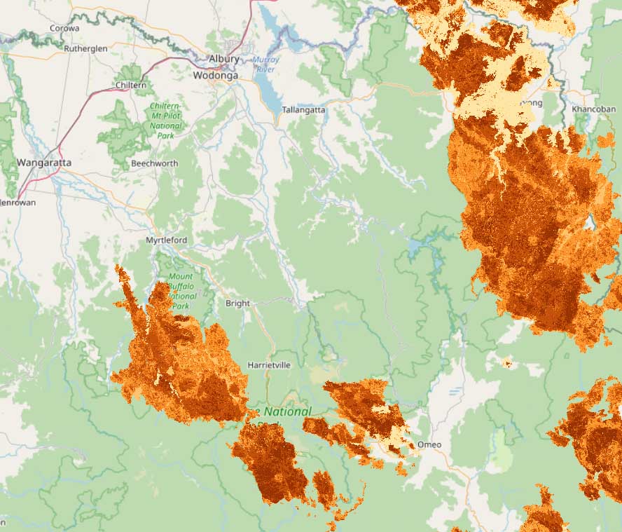
Fire Severity 2019/2020
Fire
This data shows the difference in the Normalised Burn Ratio (dNBR) between pre-fire and post-fire earth observation (satellite) imagery. This ratio uses near infrared and shortwave infrared imagery to highlight areas of vegetation impacted by fire. Larger dNBR values generally indicate more severe fire damage whereas negative values may indicate regrowth following a fire. Image sources are either Sentinel 2 (S2) or Landsat 8 (LS8); image source and reference dates are indicated in lineage section of this record.
https://data.gov.au/dataset/ds-listtas-1e9ccadc-02db-4ec2-b724-2cc20fcfeae9/details?q=
Under construction
All three geographically isolated populations are threatened by
- Habitat destruction and fragmentation (due to ski resort development and road, dam and aqueduct construction), erosion and weed invasion and increasing catastrophic events such as fires.
- Predation by feral animals, including foxes and cats.
- The effects of small population size and consequent inbreeding.
- A changing climate which reduces available habitat, interferes with the insulating effects of snow during hibernation and the seasonal migration of the Bogong Moths; a critical food source during the breeding season. The migration of additional temperate species into these areas would also have devastating effects on the remaining populations of Mountain Pygmy-possums