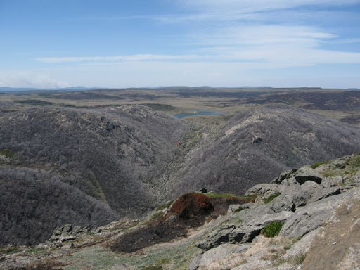
MOUNT BUNDARA
Excerpts from The Boundaries of “Jaithmathang Country — An Exploration of Ethnohistorical Sources” – Prepared by: Jacqui Durrant Ph.D
Description of the boundaries of Jaithmathang Country
Yaitmathang country stretches westwards to Mount Bogong and the Bogong High Plains via the Mitta Mitta River and its sources (the Big, Bundara, and Cobungra Rivers). This includes country above the snow-line on the Bogong High Plains, including most notably the area of Mount Cope, and by extension, additional bogong moth aestivation sites on Mount Bundara and Mount Jim.
These Bogong High Plains are geographically delineated to the south by the upper valley of the Cobungra River, and to the east by the Kiewa River west branch.
The full statement by Jacqui Durrant Ph.D can be read at www.jaithmathang.com.au