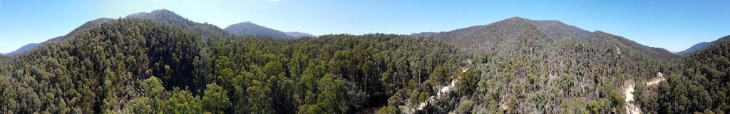
STRAIGHT RUNNING CREEK
Excerpts from The Boundaries of “Jaithmathang Country — An Exploration of Ethnohistorical Sources” – Prepared by: Jacqui Durrant Ph.D
Description of the boundaries of Jaithmathang Country
The boundary between the Yaitmathang and Tinne-mittong (Dyinning-middha) is undocumented, but geography and folk history suggests a high point of the Gibbo Range on the Benambra- Corryong Road marks the division of country, in the vicinity of where Straight Running Creek joins the Gibbo River.
Jean Carmody, 1981
Aside from the context of Charlotte’s escape from King’s Halfway House, implying that her situation had been one of slavery and abuse, Charlotte’s story also signifies that the Gibbo Range90 (pronounced with a soft ‘g’, as in ‘giant’) was seen as a considerable geographical boundary between the Omeo Plains and the Upper Murray in the minds of both Corryong locals and Charlotte herself. The path taken by Charlotte from what is now King’s Flat on the Gibbo River, to the point where the Corryong Creek (historically also known as the ‘Jeremal River’) enters the Murray River, roughly followed what is now the Benambra-Corryong Road.
Alfred Currie Wills, 1858
In terms of his geographical description, Wills’ phrase ‘Westwards towards the Bogong mountain range, via the Gibbo and Mitta Mitta Rivers’ requires explanation: The Gibbo River is a tributary of the Mitta Mitta River, flowing into it just north of Benambra. To head in the direction ‘westwards’ from this point is to follow the Mitta Mitta up-stream towards its sources (the Big, Bundara and
31 Report of the Select Committee of the Legislative Council on the Aborigines, John Ferres, Government Printer, Melbourne, 1859, p.77.
32 Report of the Select Committee of the Legislative Council on the Aborigines, John Ferres, Government Printer, Melbourne.
33 There was a camping ground at the confluence of the Snowy Creek and Mitta Mitta Rivers at Mitta Mitta township.
34 A. C. Wills, in Report of the Select Committee of the Legislative Council on the Aborigines, op cit., p.26.
Cobungra Rivers) which flow from the eastern and southern fall of the Bogong High Plains, entering the Mitta Mitta in proximity to Angler’s Rest. On the basis of Wills’ description it is a matter of interpretation to say how far west (ie: into the Alps) Yaitmathang country reaches, depending on how one interprets what it means to reach to those ranges.
The full statement by Jacqui Durrant Ph.D can be read at www.jaithmathang.com.au